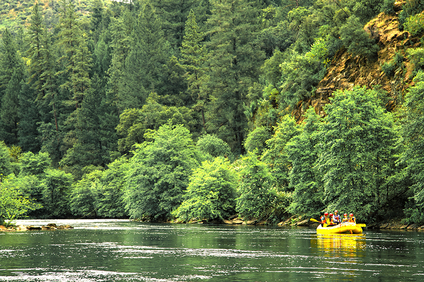
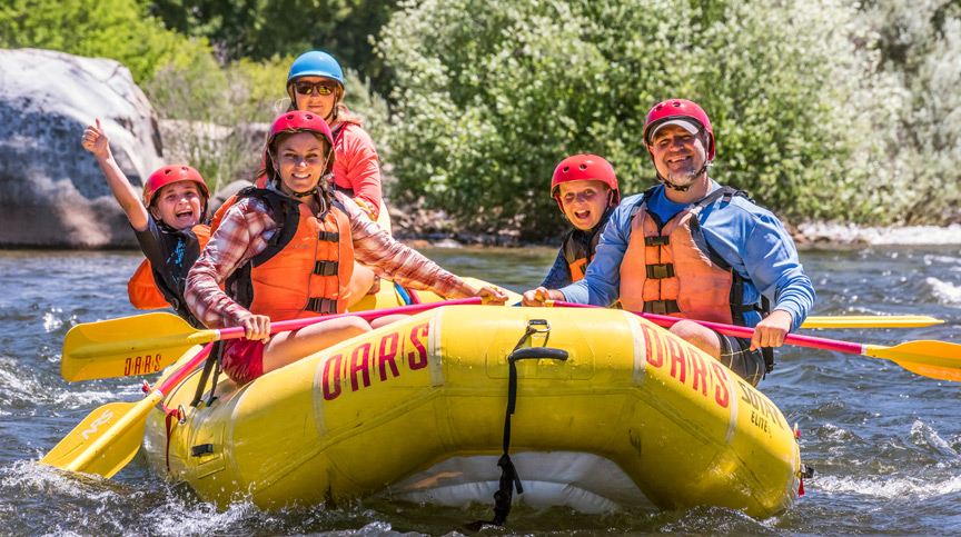
Popular South Fork American River Rafting Trips
The South Fork of the American River is a great stretch of whitewater for novice to beginner rafters. As an experienced adventure seeker, you might be interested in running the South Fork of the American as a private boater. There are a few common sections which boaters choose between based on difficulty, ease of access, and length of desired trip. The three most common trips are the Chili Bar Run, the 21 Miler, and the Gorge Run. There is also a great Class II stretch of whitewater between Coloma and the Greenwood Creek take-out.
For a detailed description of the rapids you will encounter in each section, please visit the mile by mile guide.
To run a private trip down the river, an access permit is required.
Chili Bar Run
This 8 mile stretch of whitewater is a popular option, especially for intermediate to advanced boaters seeking a shorter, half-day trip. The first two rapids are Meatgrinder (III+) and Sluice Box (III-), which make an exciting start to the trip. At normal flows, the Class III rapids include First Threat, Third Threat, and Troublemaker. At higher water levels, Troublemaker can turn into a Class IV rapid, where boaters should use extreme caution. A relaxing stretch of Class II whitewater wraps up the trip.
Put in at the Chili Bar Dam. Take out at Henningsen-Lotus Park.
Advantages: Short, exciting, and beautiful scenery
Disadvantages: Access Fees at both ends of the trip
Put-in: Chili Bar Dam
Take-out: Henningsen-Lotus Park
21 Miler
This full-day adventure is long, but it moves quickly due to the steady descent and swift current of the South Fork of the American River (note: reduced flows after July may extend the duration of your trip). The day begins with the exciting rapids on the Chili Bar Section, including Meatgrinder, Sluice Box, and Troublemaker. Troublemaker warrants caution as it can become a Class IV rapid at higher water levels.
There is a long stretch of calmer Class II whitewater between Troublemaker and Fowler’s Rock; this section is great for floating, relaxing, swimming, and eating lunch. Many people choose to lunch at Henningsen-Lotus Park or at one of the many BLM beaches which become common downstream of the residential and commercial properties.
After Fowler’s Rock, boaters will enter the Gorge with exciting Class III rapids such as Satan’s Cesspool, Son of Satan’s, and Hospital Bar. The Class III whitewater here is more continuous, with fewer long stretches of calmer water for relaxation. At the end of the Gorge Run, boaters enter Folsom Lake; depending on the water levels, there is a short paddle to the Salmon Falls Bridge to take out.
Put-In: Chili Bar Dam
Take-Out: Salmon Falls Bridge
Advantages: An exciting full-day adventure of Class III whitewater
Disadvantages: Long shuttle, paddling the lake at the end of the day; there is a boat towing service available when the lake levels are high enough. If you set your own shuttle, there are fees at both ends of the trip.
Coloma to Greenwood Creek
If you’re looking for a relaxing and fun stretch of Class II whitewater, then the section between the Marshall Gold Discovery State Park and Greenwood Creek is perfect. This 5.6 mile section of river is composed of flat water and a few Class I-II rapids. Rapids include Beginner’s Hole, Laughing Eddy, Lotus Ledge Surfing Hole, and Barking Dog Rapid. There are long stretches of flat water to get out and swim, and various beaches along the way offer perfect lunching opportunities.
Please note that this put-in is highly regulated by the State Park. You must have permission, and there are use fees associated. To discuss your desire to put-in and the potential use fees, please contact the Marshall Gold Discovery State Park. If you would prefer an easier put-in for a Class II float, try putting in at the bridge (if there is parking along the road) or at the Henningsen-Lotus State Park.
Advantages: Great half-day adventure for beginners with Class II whitewater. Easy, relaxing float.
Disadvantages: Marshall Gold Discovery State Park is highly regulated. The Greenwood Creek has a longer hike than other put-ins and take-outs.
Put-in: Marshall Gold Discovery State Park
Take-out: Greenwood Creek
Gorge Run
This stretch of whitewater is 12.5 miles long. It is particularly popular with those seeking to do a longer half-day trip; if a boater takes his or her time, then it can easily be made into a full-day adventure. The trip begins with moderate Class II whitewater, which serves as a warm-up for the exciting rapids in the Gorge.
The first Class III rapid is Fowler’s Rock, recognizable by the large boulder in the middle of the river. Entrance into the Gorge occurs after the third sighting of the “Lollipop Tree,” an odd tree with a circle of leaves, situated on top of a distant hill.
Once boaters enter the gorge, they’re greeted with a series of Class III rapids, including Satan’s Cesspool, Son of Satan’s, Scissors, Bouncing Rock, Pre-Op, Hospital Bar, and Recovery Room. At lower water levels, an additional Class III rapid is Surprise.
Advantages: A medium-length run with numerous exciting Class III rapids
Disadvantages: Earlier in the season, boaters must paddle the lake to reach the take-out. In the peak of the season, boaters can pay a small fee to be towed. If you set your own shuttle, there are fees at both ends of the trip.
Put-in: Henningsen-Lotus Park
Take-out: Salmon Falls Bridge
Greenwood Creek to Folsom Lake
If you’re interested in a short Class III trip, then you should try starting at Greenwood Creek and ending at Folsom Lake. This section of whitewater includes all the exciting rapids of the Gorge, with minimal floating through long stretches of Class II whitewater. This trip starts just above Swimmer’s Rapid and travels 9.1 miles to the take-out at Salmon Falls Bridge. Exciting rapids include Satan’s Cesspool, Bouncing Rock, Pre-Op, Hospital Bar, and Recovery Room. At lower water levels, an additional Class III rapid is Surprise.
Advantages: A short Class III trip with limited long stretches of Class I-II whitewater
Disadvantages: the put-in at Greenwood Creek is longer than at most other put-ins and take-outs.
Put-in: Greenwood Creek
Take-out: Salmon Falls Bridge
Mile by Mile Guide
| Mile 0 | CHILI BAR DAM. This is a popular put-in for a half- or full-day trip. |
| Mile 0.3 | CHILI BAR HOLE (II). For many years Chili Bar Hole was the site of the Chili Bar Rodeo. On low-water years, the competition moved downstream to First Threat Rapid. Chili Bar was named after the Chilean road builders during the early Gold Rush days. |
| Mile 0.6 | MEATGRINDER (III). A long rock garden with big waves and a hidden boulder at the bottom. Meatgrinder is also known as “Quarter Mile Rapid” because of its length. At high flows, this rapid has some huge waves and holes. |
| Mile 1.3 | RACEHORSE BEND (II+). At Racehorse Bend rapid, the river drops and bends left, pushing current into the right wall. Swimming here is not recommended, especially at low summer flows. |
| Mile 1.5 | MAYA (II-III). Maya is a favorite surf and lunch spot for kayakers and private rafters. It’s normally a pretty easy run down the middle, but there is a big hole at higher flows. There is a sneak route on the far right. |
| Mile 1.8 | ROCK GARDEN (II). As its name implies, this is a rock garden to be maneuvered through with skill. |
| Mile 3.0 | Site of old miner’s cabin on right bank. |
| Mile 3.1 | TRIPLE THREAT (III). Three separate drops, and all three can be run down the middle. The third drop is after a sharp left-hand bend. First Threat Rapid is a favorite kayak surfing hole and home of the American River Festival Rodeo. |
| Mile 5.2 | TROUBLEMAKER (III+). This is the biggest rapid on the upper section of this whitewater rafting trip. The river bends sharply right and then left, passing Gunsight Rock. It’s also sometimes referred to as “S-Turn” rapid. Professional photographers frequently are stationed riverside, as are a host of whitewater enthusiasts – often cheering and applauding as you pass through the rapid. You may review and/or purchase photos after completing your American River rafting experience. |
| Mile 5.6 | Coloma Bridge. Built in 1917, this one-lane bridge is the thenth structure to have spanned the site. In 1850, Ed Raun reportedly collected up to $250 in tolls per day. |
| Mile 5.7 | COLOMA. Put-in only; on River Left. This put-in is only available to non-commercial boaters who are seeking an easy Class II run. The longest stretch of Class II whitewater is approximately 5.6 miles, between the Coloma put-In and the Greenwood Creek take-out. |
| Mile 5.9 | Marshall Gold Discovery State Park. The park sprawls across both sides of the highway, encompassing a museum, a full-scale replica of Sutter’s Mill where the Gold Rush started, as well as a ghost town of restored period buildings and Gold Rush artifacts. At the museum you can buy a gold pan and learn how to pan for gold. Bekeart’s Gun Shop, located in the Park, offers similar activities and old-fashioned trade goods. |
| Mile 6.6 | BEGINNER’S HOLE RAPID (II). Also known as “Taco Bender.” This is a fun play spot for kayakers. |
| Mile 7.0 | OLD SCARY (II). The river bends sharply left, with an island midstream. Old Scary used to be one of the most difficult rapids on the Chili Bar-to-Coloma section of the South Fork until high water in 1982 rearranged it. |
| Mile 7.4 | Highway 49 bridge and highway access. |
| Mile 8.0 | HENNINGSEN-LOTUS STATE PARK. Put-in or take-out, located on River Left. This is a popular starting or ending point for half-day trips. It is also a great lunch spot. |
| Mile 8.5 | LOTUS LEDGE SURFING HOLE (II). This used to be a fun little ledge hole, but it was wiped out in the flood of January 1997, and is now simply a riffle. |
| Mile 9.0 | Camp Lotus. Located two miles from historic Coloma, this campground is situated along the South Fork of the American River. |
| Mile 9.0 | BARKING DOG RAPID (II+). This is a fun little surfing wave where kayakers like to practice their rolling skills. |
| Mile 9.7 – 9.9 | BLM Public Land and Dave Moore Nature Area on right. |
| Mile 10.6 | CURRENT DIVIDER RAPID (II+). A rocky chute. |
| Mile 11.2 | HIGHWAY RAPID (II+). A long, curving rock garden. |
| Mile 11.4 | SWIMMER’S RAPID (II). Swimmer’s Rapid is a great spot to jump in and experience what it feels like to swim a rapid. It is a fun wave train rapid. |
| Mile 11.5 | GREENWOOD CREEK. Put-in or take-out, located on River Right. For boaters putting in here, the following stretch of whitewater offers a short and action-packed half-day trip through the Gorge. For less-experienced boaters who want to avoid the more complicated Gorge section, this is a great take-out. There are no access fees here, but the walk between your car and the river is longer. |
| Mile 13.9 | Gorilla Rock and Convict Rock. This rock really looks like a gorilla. The outcropping just downstream is called Convict Rock. It was named in July 1903 when a storekeeper spotted the clothes of 13 escaped Folsom Prisoners. Six of the prisoners were found within six months, but the remaining seven – including the leader “Red Shirt” Gordon – were never found. |
| Mile 15.0 | Lollipop Tree. This round tree signals your approach into the lower gorge. Entrance to the Gorge occurs after the third sighting of this tree. |
| Mile 15.8 | FOWLER’S ROCK (III). This is the first big rapid on the South Fork’s lower section. The river bends left into a short pool then back to the right where a boulder cluster marks the entry to the rapid. Boaters can run either to the left or to the right at normal and high flows; at lower flows, only the run to the right is possible. |
| Mile 16.0 | UPPER HAYSTACK CANYON (II+). The river drops quickly, creating large standing waves. |
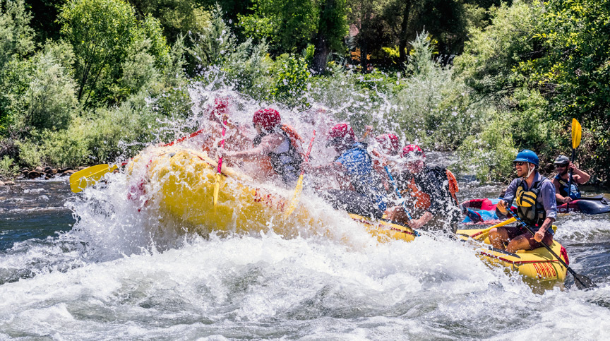
| Mile 16.9 | SATAN’S CESSPOOL (III+). Satan’s is the biggest rapid in the Gorge Run of the South Fork of the American River. After a long pool, the river pours over a sharp drop (Lost Hat), then bends left and right into a bigger drop against the left wall. There is a small eddy on the left just down stream. A rock above the final drop provides a good vantage point for photographers and spectators. Professional photographers are frequently stationed here with their cameras. |
| Mile 17.0 | SON OF SATAN’S or DEAD MAN’S DROP (II+). There is a submerged rock in the center of this rapid, with most of the whitewater pushing towards the right into a rock wall. |
| Mile 17.4 | SCISSORS (III). The river turns left down a narrow, rocky chute with big, irregular waves. |
| Mile 17.6 | LOWER HAYSTACK CANYON (II+). A fun, bouncy rapid with big standing waves and short drops in a narrow section. |
| Miles 17.7 – 18.1 | BLM Land on both sides makes for great public stopping points. |
| Mile 18.1 | Weber Creek – a large, year-round creek on river left. |
| Mile 18.2 | BOUNCING ROCK (II+). This rapid, with a big hole on river right, provides a bouncy whitewater ride. |
| Mile 18.6 | HOSPITAL BAR (III). Named for a medical tent set up here during the Gold Rush, this is the last big, splashy rapid on The Gorge Run. The rapid is a rock chute that bends left and then right. It provides surprising whitewater fun. Professional photographers are sometimes stationed here with their cameras. |
| Mile 18.8 | RECOVERY ROOM (II+). Big, fun waves and clean drops. |
| Mile 19.4 | SURPRISE RAPID (II+). If the Folsom Reservoir is full, there will be a flat-water paddle, and this rapid will be under water. There is an optional tow out of the lake for a small fee. If the reservoir is low, Class II rapids continue to mile 20. It is a treat to find Surprise Rapid uncovered! |
| Mile 20.5 | SALMON FALLS BRIDGE. Final take-out for all trips on river right. |
Rapid Classification via American Whitewater
| Class I | Fast moving water with riffles and small waves. Few obstructions, all obvious and easily missed with little training. Risk to swimmers is slight; self-rescue is easy. |
| Class II | Straightforward rapids with wide, clear channels which are evident without scouting. Occasional maneuvering may be required, but rocks and medium-sized waves are easily missed by trained paddlers. Rapids that are at the upper end of this difficulty range are designated “Class II+”. |
| Class III | Rapids with moderate, irregular waves which may be difficult to avoid and which can swamp an open boat. Complex maneuvers in fast current and good boat control in tight passages or around ledges are often required; large waves or strainers may be present but are easily avoided. Strong eddies and powerful current effects can be found, particularly on large-volume rivers. Scouting is advisable for inexperienced parties. Injuries while swimming are rare; self-rescue is usually easy but group assistance may be required to avoid long swims. Rapids that are at the lower or upper end of this difficulty range are designated “Class III-” or “Class III+” respectively. |
| Class IV | Intense, powerful but predictable rapids requiring precise boat handling in turbulent water. Depending on the character of the river, it may feature large, unavoidable waves and holes or constricted passages demanding fast maneuvers under pressure. A fast, reliable eddy turn may be needed to initiate maneuvers, scout rapids, or rest. Rapids may require “must” moves above dangerous hazards. Scouting may be necessary the first time down. Risk of injury to swimmers is moderate to high, and water conditions may make self-rescue difficult. Group assistance for rescue is often essential but requires practiced skills. Rapids that are at the lower or upper end of this difficulty range are designated “Class IV-” or “Class IV+” respectively. |
| Class V | Extremely long, obstructed, or very violent rapids which expose a paddler to added risk. Drops may contain large, unavoidable waves and holes or steep, congested chutes with complex, demanding routes. Rapids may continue for long distances between pools, demanding a high level of fitness. What eddies exist may be small, turbulent, or difficult to reach. At the high end of the scale, several of these factors may be combined. Scouting is recommended but may be difficult. Swims are dangerous, and rescue is often difficult even for experts. Proper equipment, extensive experience, and practiced rescue skills are essential. Because of the large range of difficulty that exists beyond Class IV, Class 5 is an open-ended, multiple-level scale designated by class 5.0, 5.1, 5.2, etc… Each of these levels is an order of magnitude more difficult than the last. |
| Class VI | These runs have almost never been attempted and often exemplify the extremes of difficulty, unpredictability and danger. The consequences of errors are very severe and rescue may be impossible. For teams of experts only, at favorable water levels, after close personal inspection and taking all precautions. After a Class VI rapid has been run many times, its rating may be changed to an appropriate Class 5.x rating. |
Put-ins and Take-outs
There are five main locations where you can put in and/or take out on this section of river. Please note that many require a river access fee, a parking fee, or both.
Chili Bar (put-in only)
The Chili Bar is the first available put-in on the South Fork of the American River, located just below the Chili Bar dam, about ten minutes from downtown Placerville. This park is run by the American River Conservancy.
Fees
Day Pass, 1 Car $3
Day Pass, 1 Person $3
Unrestricted Season Pass $90
Up to 4 people in 1 car, valid 7 days a week
Restricted Season Pass $65
Up to 4 people in 1 car, valid Monday—Friday
Single Unrestricted Season Pass $60
1 person in 1 car, valid 7 days a week
Single Restricted Season Pass $35
1 person in 1 car, valid Monday—Friday
Purchase a day or season pass in advance here.
Hours:
Open 8:00 AM to 8:00 PM during the summer. Hours and access are limited during the fall, winter and spring.
For additional information, including park rules and regulations, please visit the American River Conservancy. Safety recommendations are also available.
Directions from Coloma: Take Hwy 49 southeast (away from the Marshall Gold Discovery State Park). When Hwy 49 makes a sharp left turn, make sure you follow the road. Continue 7.1 miles, after which you’ll turn left on Georgetown Rd. (if you enter Placerville, you’ve gone too far). After you cross the bridge, turn left into the Chili Bar River Park and find parking.
1667 Chili Bar Ct
Placerville, California 95667
Coloma, aka Marshall Gold Discovery State Park (put-in only)
In the middle of the Marshall Gold Discovery State Park, there is a great private trip put-in for the South Fork of the American River. This put-in is located in the heart of Coloma, with ample parking and easy access to the river. This park is run by the California Department of Parks and Recreation. This put-in offers access to the longest stretch of Class II whitewater on the South Fork of the American, which is great for novice and intermediate boaters looking to get their feet wet. The recommended take-out for the Class II stretch is at Greenwood Creek.
Please note that this put-in is highly regulated by the State Park. You must have permission, and there are use fees associated. To discuss your desire to put-in and the potential use fees, please contact the Marshall Gold Discovery State Park at (530) 622-3470.
If you would prefer a less regulated put-in for a Class II float, try putting in at the bridge (if there is parking along the road) or at the Henningsen-Lotus State Park.
In addition to being a put-in and take-out on the South Fork of the American River, the Marshall Gold Discovery Park has activities for all ages, including a museum, hiking trails and gold panning lessons. More information can be found here.
Please check the Marshall Gold Discovery State Park website for additional information. The Gold Discovery Park Association website is another great resource.
Park Hours
Winter Hours (Labor Day to Memorial Day weekends): 8:00 AM – 5:00 PM
Summer Hours (Mar – Nov): 8:00 AM – 7:00 PM
North beach closed November 1st – March 1st
Directions from Coloma: Drive northwest into the Marshall Gold Discovery State Park. The parking lot will be the last right as you pass through the park. If you have approval to put in here, follow the directions you receive from the State Park.
310 Back St
Coloma, CA 95613
Henningsen-Lotus Park (put-in or take-out)
This is one of the most accessible boat launch areas on the South Fork of the American River, located right next to the bridge on Highway 49. This park is run by the County of El Dorado. Many boaters choose to avoid the fees at the Henningsen-Lotus Park by putting in at the bridge which crosses the South Fork of the American River. Boaters will park along the road near the 3-way stop and hike down to the river with their equipment. Space is limited, so arrive early.
Vehicle Fees
Private Vehicle $5
Bus (Private or Commercial) $45
Mini-bus or Van (Private or Commercial) $22
Annual Pass (private vehicle only) $18
Violation for non-payment of parking fees $20
There is no charge for loading and unloading boats, assuming that stay is less than 15 minutes.
River Access Fees
Private Rafts or Boats $5
Private Kayak or Single Person Craft $1
Violation for non-payment of river access fees $20
For additional information on fees, including fees for day use of the ball fields and the pavilions, please check the website.
Park Hours
Monday – Sunday from 8:00 AM to dusk
Directions from Coloma: Drive northwest through the Marshall Gold Discovery State Park. At the 3-way stop sign, turn left onto Lotus Rd. Henningsen-Lotus park is a half-mile down the road on your right.
950 Lotus Road
Lotus, CA 95651
Greenwood Creek (put-in or take-out)
This beautiful little spot is a great option for a put-in if you want a short run of the South Fork of the American River. It is also the last available take-out if you do not wish to run the Gorge section of the river. There are no access fees, so parking there is free; however, the hike to the river is a little longer at about a quarter mile. Recent additions to this access include a larger parking lot and pit toilets.
Directions from Coloma: Drive northwest through the Marshall Gold Discovery State Park. Pass through the 3-way stop sign to cross the bridge. Drive 3 miles, after which you’ll see the Greenwood Creek parking lot on your left. If you see Lilyama Road on the right, you’ve gone too far.
GPS Coordinates: 38.82589, – 120.9475
Salmon Falls Bridge (take-out)
If it’s early in the season, you might have a short paddle on the reservoir to Salmon Falls Bridge on Folsom Lake, which is the final take-out for the South Fork of the American River. The access point is sometimes known as Skunk Hollow. It is managed by the Folsom Lake SRA.
As the lake levels drop later in the season, it’s possible to raft right up to the bridge. The private boat take-out is on the right-hand side of the lake, right at the base of the bridge. There is plenty of parking available. Public restrooms are available.
Fees:
Day Use $10
Hours:
7:00 AM to 8:00 PM, seven days a week
Closed November 1st to April 1st
Directions from Coloma: Drive northwest through the Marshall Gold Discovery State Park. Cross the bridge over the South Fork of the American River and drive for 6.7 miles. Turn left onto Salmon Falls Cutoff Rd, and then turn left again onto Salmon Falls Rd. The Salmon Falls parking lot is 5.7 miles on your left; if you cross the Salmon Falls Bridge, you’ve gone too far.
GPS Coordinates: 38.77384894, -121.03447149
Private Trip Permits
A plastic permit tag is required for all private trips on the South Fork of the American River. This tag must be attached to each boat, and contains important health and safety guidelines for all boaters, whether novice or experienced. The permits also include a map of the river, including restroom locations, campgrounds, and quiet zone boundaries.
Private trip permits are available for purchase from the American Rivers Conservancy online here and at the Chilli Bar put-in.
All private boaters are held accountable to the rules and regulations put forth by the Bureau of Land Management.
Services
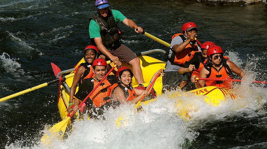
There are two main companies which take photographs of the boaters on the Gorge. They are usually stationed at a couple locations, including Meatgrinder and Troublemaker on the Chili Bar section, as well as Satan’s Cesspool and Hospital Bar on the Gorge section.
(530) 621-0400
7308 Hwy 49, Unit E
Lotus, CA 95651
The Coloma Shuttle
If you’re unable (or unwilling) to set your own shuttle for your private trip down the South Fork of the American River, then you’re welcome to ride on the Coloma Shuttle! The shuttle costs $10 per person for a day pass, or $100 per person for a 12 day pass.
See the Coloma Shuttle Schedule here. If you are traveling on Saturday or Sunday, you will be required to make a paid reservation in advance.
If you have questions, comments, or special requests, please contact the Coloma Shuttle directly at coordinator@colomashuttle.com. Additional information is available on the Coloma Shuttle website.
Tow across Folsom Lake
As of 2017, jet ski tows across Folsom Lake for private boaters have been suspended by the Park Service. Please call the Folsom Lake State Recreation Area at (916) 988-0205 for the latest information.
Commercial Outfitters
Are you excited about rafting the South Fork of the American River, but not ready to do it on your own? Or are you trying to avoid the hassle of organizing a trip on your own?
There are more than 30 permitted outfitters on the South Fork of the American River. Based in California, OARS is among the most experienced and offers a variety of trips throughout the western U.S., from half-day excursions to 18-day expeditions. To schedule a South Fork American River rafting trip with OARS, visit https://www.oars.com/adventures/south-fork-american-river-rafting/ or call 1-800-446-7238.
For outfitted kayaking trips on the South Fork of the American River, check out California Canoe & Kayak